OUR COUNTY IN PHOTOGRAPHS
Real places.
Credited photography.
These photographs show identified locations in St. Johns County. Dates, authors and reuse licenses are provided below. Images are resized and cropped for the site; none is AI generated. Their inclusion does not imply endorsement by a photographer, school, public agency or depicted person.
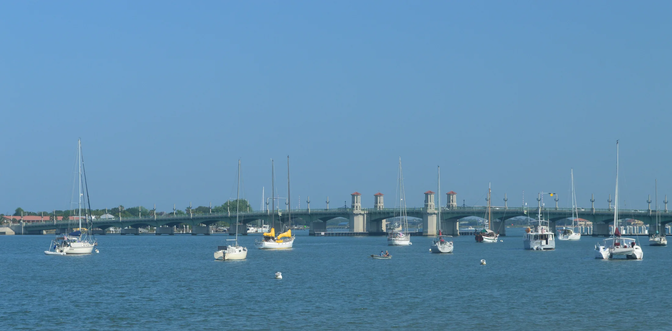
Bridge of Lions at St. Augustine
Photographed: 2016-04-29
Photographer: Randblank
Original photograph and attribution · CC BY-SA 4.0
Resized and compressed as WebP; responsive display crops. No generative changes. Adapted CC BY-SA images remain under the stated license.
Source verifies location and author; current appearance may differ from 2016.
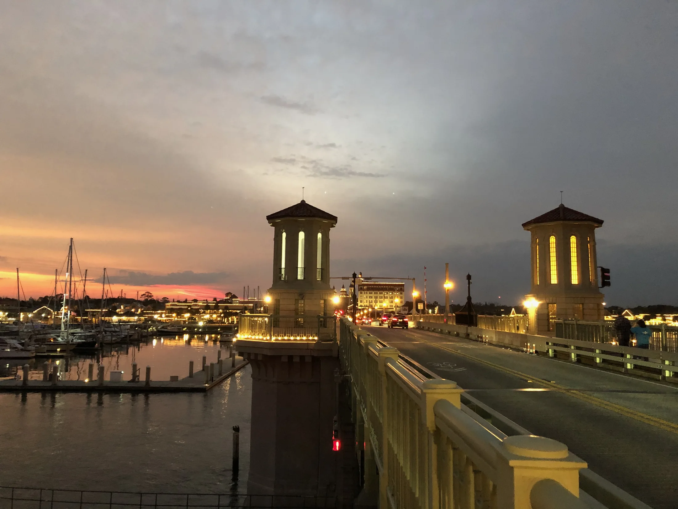
Bridge of Lions at sunset
Photographed: 2021-01-26
Photographer: Jerry Stratton (Commons user Capvideo)
Photographer’s page · Original photograph and attribution · CC BY 4.0
Resized and compressed as WebP; responsive display crops. No generative changes. Adapted CC BY-SA images remain under the stated license.
No material location uncertainty. This is a 2021 evening photograph uploaded in 2026.

Sunrise over Ponte Vedra
Photographed: 2007-09-26
Photographer: Craig ONeal
Photographer’s page · Original photograph and attribution · CC BY-SA 2.0
Resized and compressed as WebP; responsive display crops. No generative changes. Adapted CC BY-SA images remain under the stated license.
Exact beach access is not named; do not label it Mickler's Landing or a specific park. Older photograph.
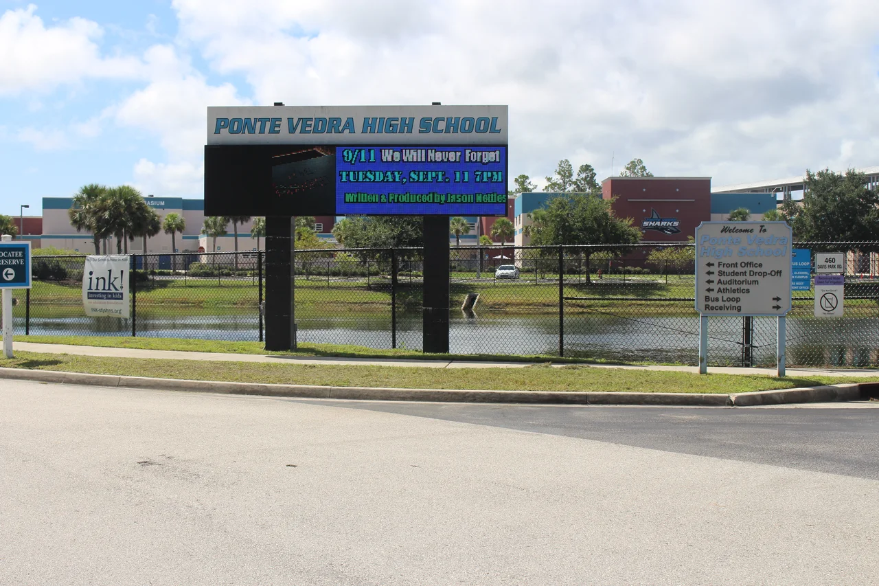
Ponte Vedra High School, St. Johns County
Photographed: 2018-09-01
Photographer: Michael Rivera
Photographer’s page · Original photograph and attribution · CC BY-SA 4.0
Resized and compressed as WebP; responsive display crops. No generative changes. Adapted CC BY-SA images remain under the stated license.
Photo is from 2018; date it in caption if it could be interpreted as current campus conditions.
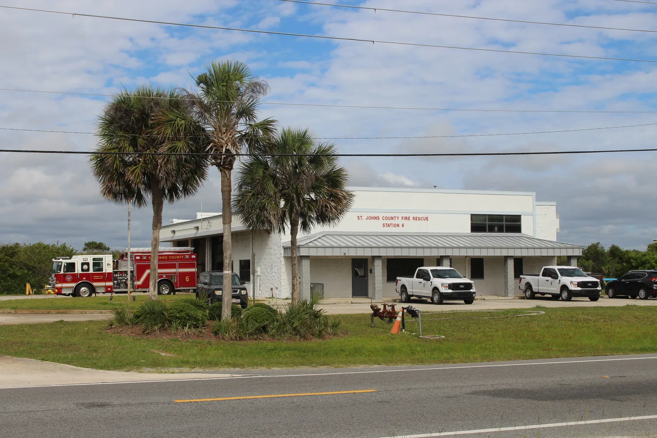
St. Johns County Fire Rescue Station 6
Photographed: 2022-06-04
Photographer: Michael Rivera
Photographer’s page · Original photograph and attribution · CC BY-SA 4.0
Resized and compressed as WebP; responsive display crops. No generative changes. Adapted CC BY-SA images remain under the stated license.
Verified station identity from signage, source filename, source geolocation, and official station address. No identifiable worker in this image.
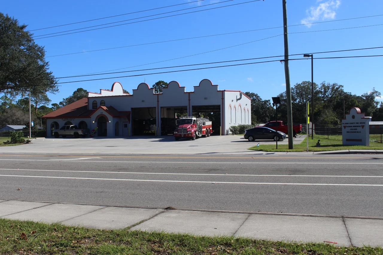
St. Johns County Florida Memorial College Fire Rescue Station No. 14
Photographed: 2024-11-16
Photographer: Mjrmtg (Michael Rivera)
Photographer’s page · Original photograph and attribution · CC0 1.0 Universal Public Domain Dedication
Resized and compressed as WebP; responsive display crops. No generative changes. Adapted CC BY-SA images remain under the stated license.
Verified by source filename, visible station sign and official county address. No identifiable worker in this image.
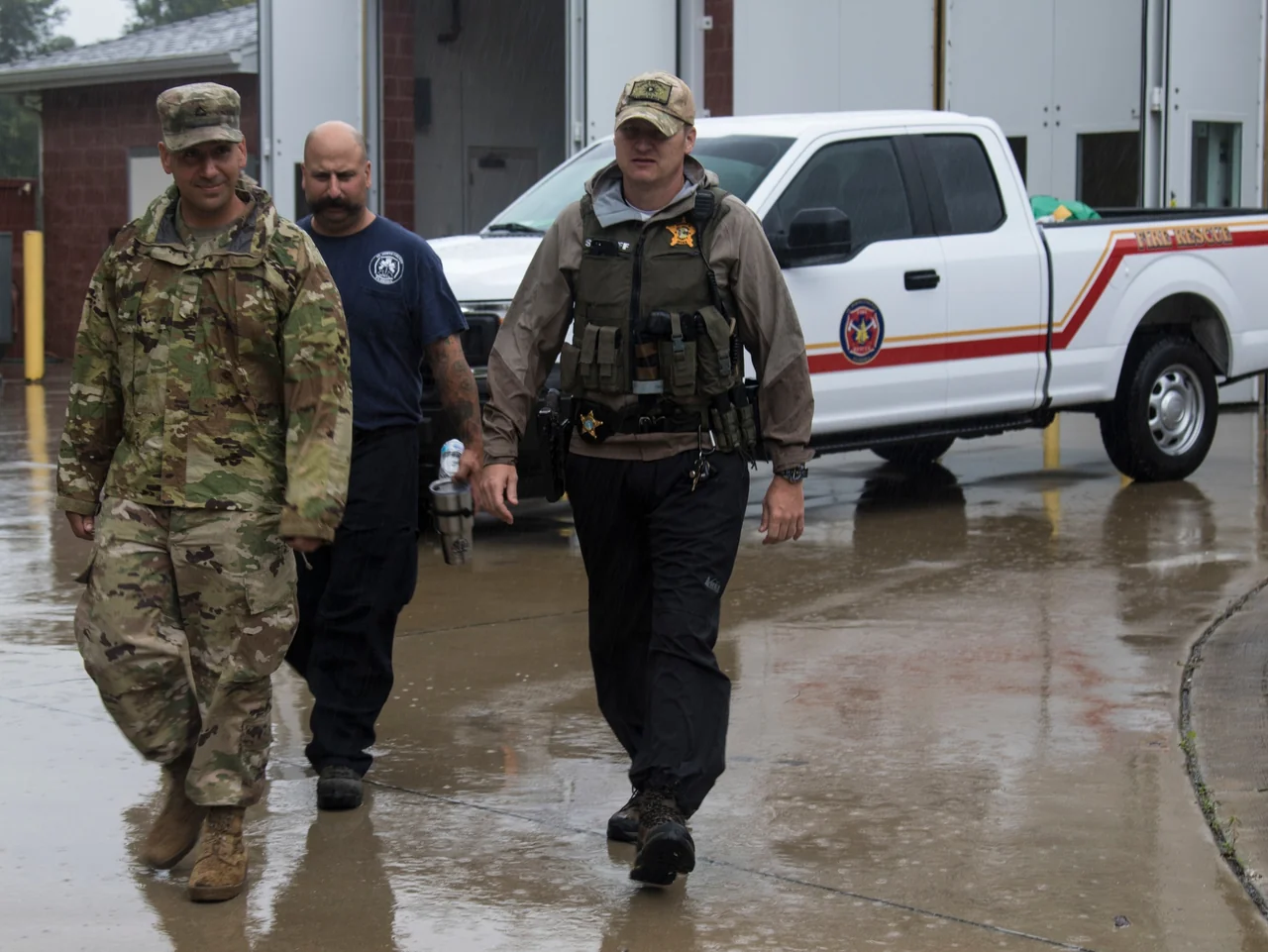
Hurricane Dorian site survey in Ponte Vedra
St. Johns County Fire Rescue firefighter John Baccari and Sheriff’s Office Detective Josh Gordon join Florida National Guard Pfc. Michael Davis on a Hurricane Dorian site survey in Ponte Vedra, September 4, 2019.
U.S. Army photo by Sgt. Leia D. Tascarini / DVIDS, public domain.
Original DVIDS record and caption · Public domain and use notice
Resized and compressed as WebP; no generative changes. Image shown in its original proportions.
The appearance of U.S. Department of War (DoW) visual information does not imply or constitute DoW endorsement.
The district map
The commission-district map is our rendering of published polygon coordinates from the St. Johns County GIS Division. It uses a north-up Mercator projection, with no invented district outlines. Labels are placed inside their corresponding district polygons.
Retrieved October 1, 2026; the source reports its most recent data edit as February 7, 2025. This is a dated reference, not a survey, school-attendance map, utility service boundary or enclave qualification determination.
Official GIS layer · Downloaded boundary coordinates · Retrieval record · County GIS and current maps
Return to the civic record