Method and limits
How the screen works
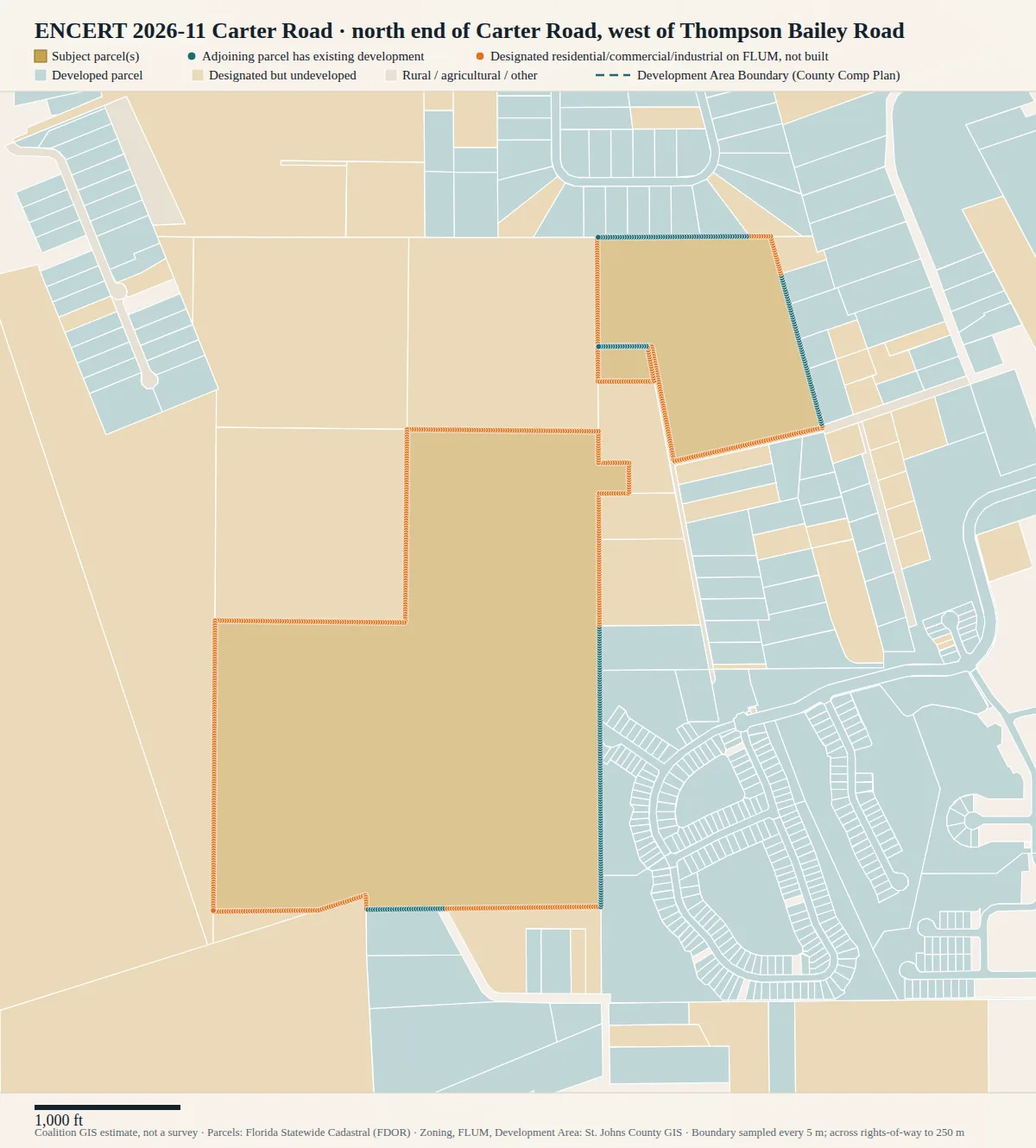
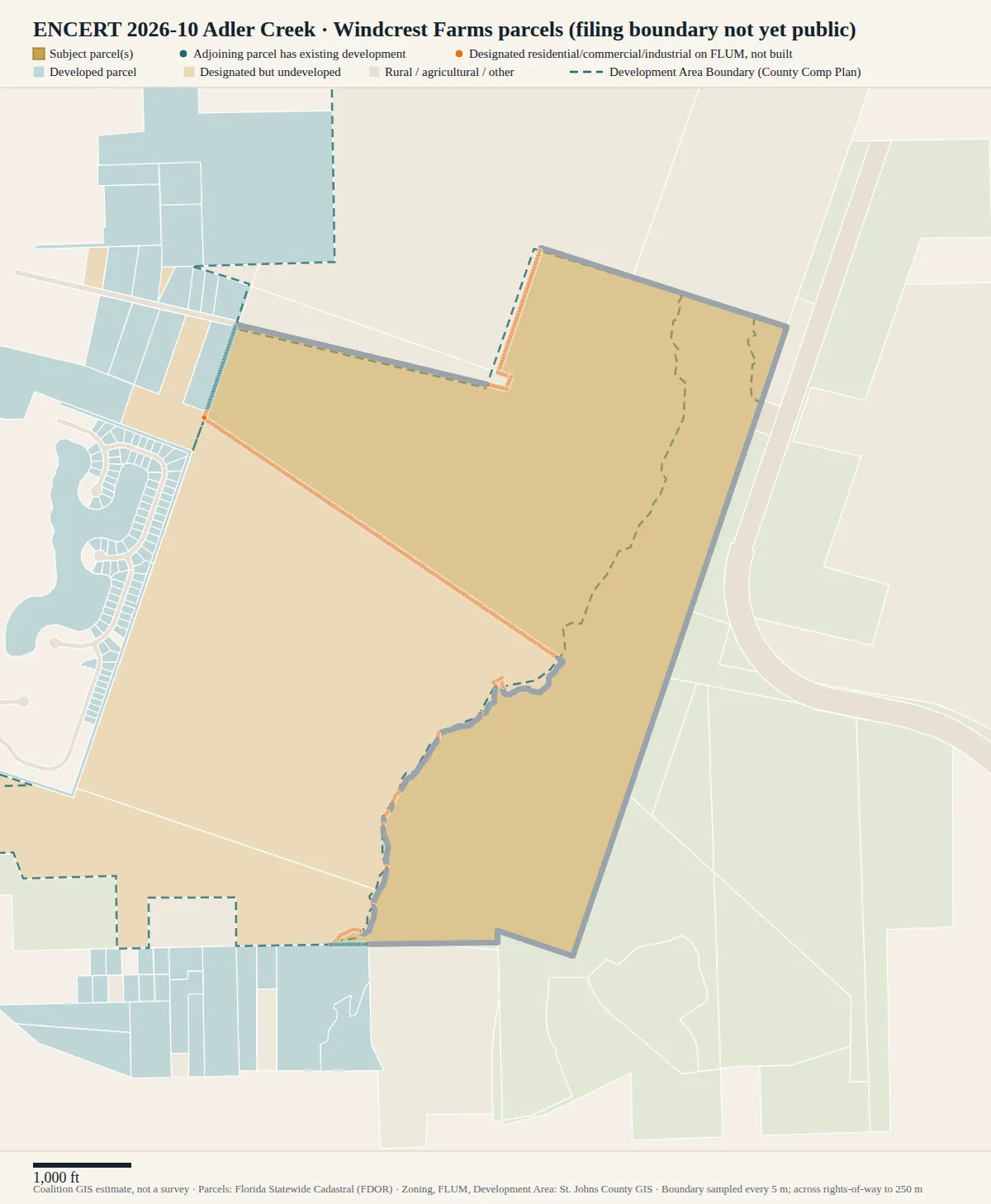
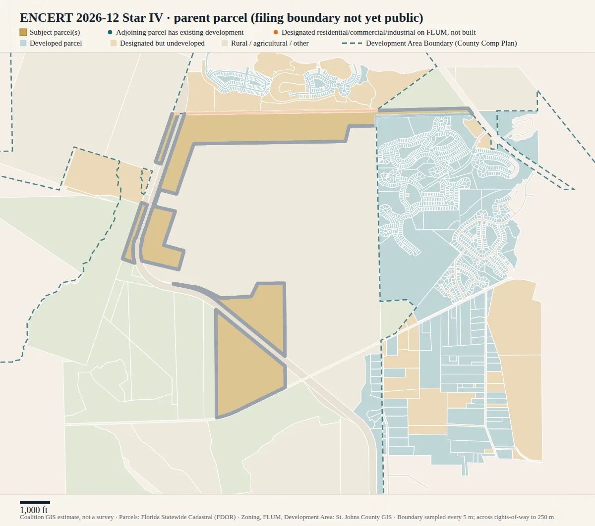
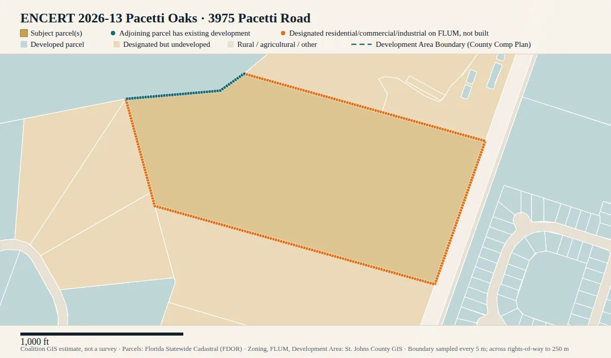
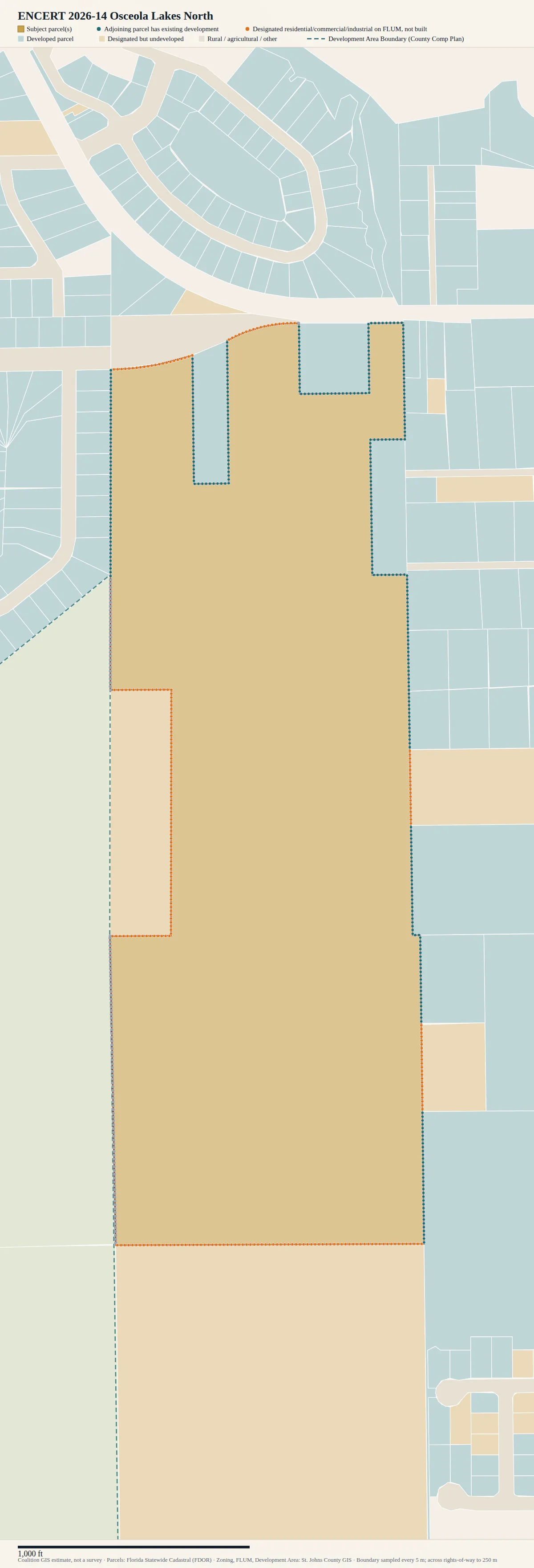
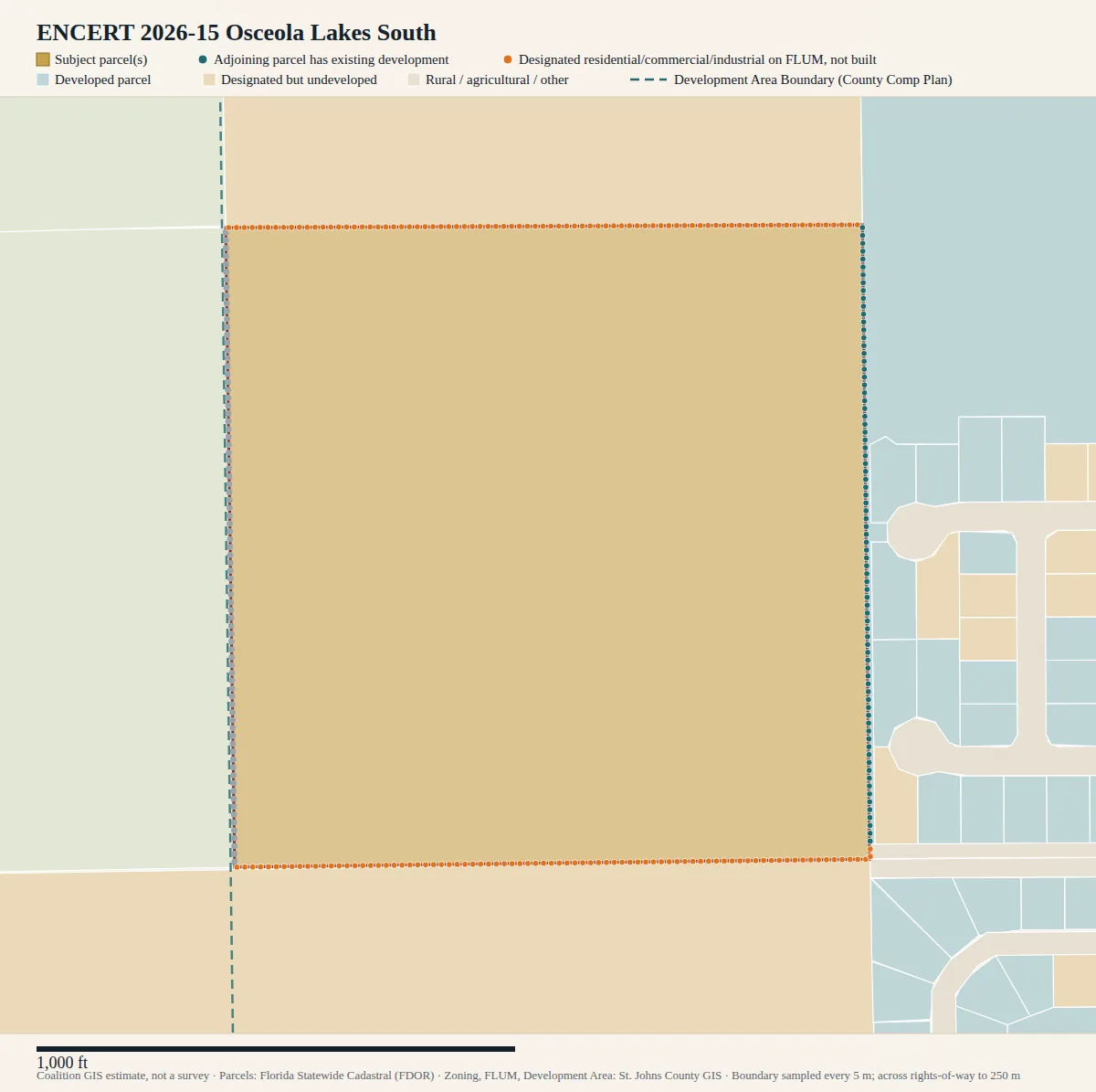
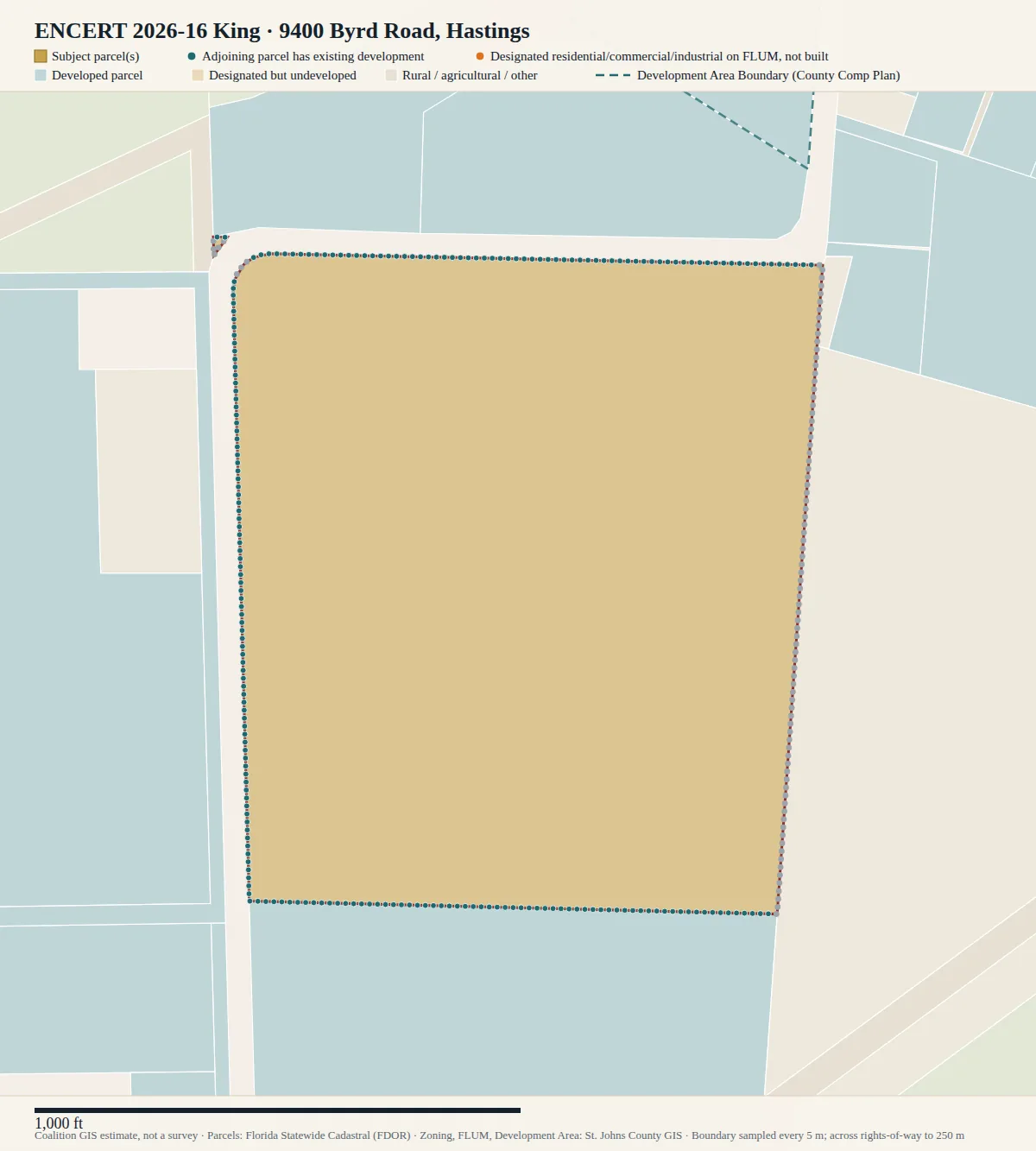
For each filing we took the subject tax parcels from the Florida Statewide Cadastral layer, merged them, and walked the boundary in 5-metre steps. At each step we looked outward—3 to 250 metres—for the first parcel that is not part of the subject, so that where a road, canal or water body lies on the edge the parcel across it is used, as the statute directs. Each step is then classified by that parcel: existing development if its Department of Revenue use code is residential, commercial or industrial (single homes on acreage count, as County staff counted them in the AFI case; vacant land does not); designated if the County's zoning layer and Future Land Use layer place it in a residential, commercial, industrial, PUD or DRI category; and urban service if it falls inside a polygon the County's Land Use Boundary layer names "Urban Service Area" or, separately, "Development Area."7 22 23 24
Subject parcels Developed parcel Designated but undeveloped Rural, agricultural or other Boundary adjoins existing development Boundary adjoins designated, unbuilt land
What it cannot do
It is not a survey, and the layers are current ones, not certified maps as of January 1, 2025. It cannot see the applicants' Exhibit A boundaries, which for Adler Creek and Star IV are not yet public, so those two are screened on alternative scenario boundaries. The scenarios do not necessarily bound the result for the boundary actually filed. It does not decide the legal questions—whether the Development Area Boundary is an urban service area, whether an owner's own excluded land counts, whether a parcel with a house is "undeveloped"—it only shows which questions matter and by how much. Percentages are rounded to one decimal; differences of a few points are within its tolerance, which is why Osceola South's 50 percent is reported as "at the minimum" rather than as a pass or a fail. The numbers behind every map are published as a data file so anyone can check them.
What we did not do
We did not assign pass or fail verdicts to applications the County has not ruled on, and we did not treat withdrawal, refiling or a smaller boundary as evidence of bad faith; each is lawful. We did not reach ownership, five-year agricultural use or public-services conclusions where the deeds, classification history and utility letters are not public. Public-records requests for the full files were submitted October 1; the hearing packets will supersede this screen as they post.